St. George To Mount Carmel On Highway 09 (Day Two )
Today we took a detour through Zion National Park (Wikilink) and then drove US Highway 89 until we reached Gunnason Utah where we went on SR-28 which reconnected with I-15 just south of Spanish Creek Utah.
Morning Departure From St. George

An aerial shot of St. George

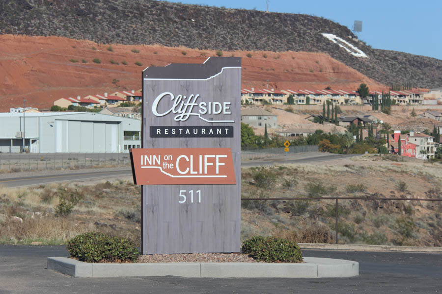
Our hotel had a fantastic view

The sun gave the city an eerie red glow due to it's angle and the red soil
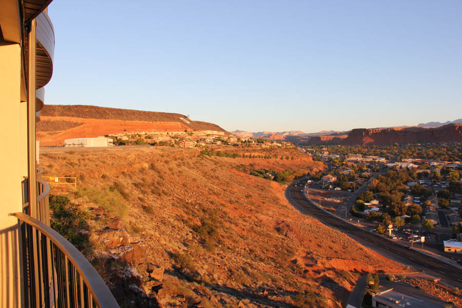
From our balcony... See the "D" for Dixie?
Looking out across the city

Bluff Street below
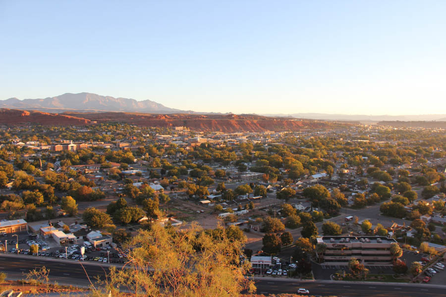
It was closer to 9:00 am and the Sun's angle has increased
Smog? Nope! Just fresh air!

The Tabernacle looked different in the daytime
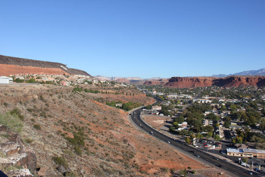
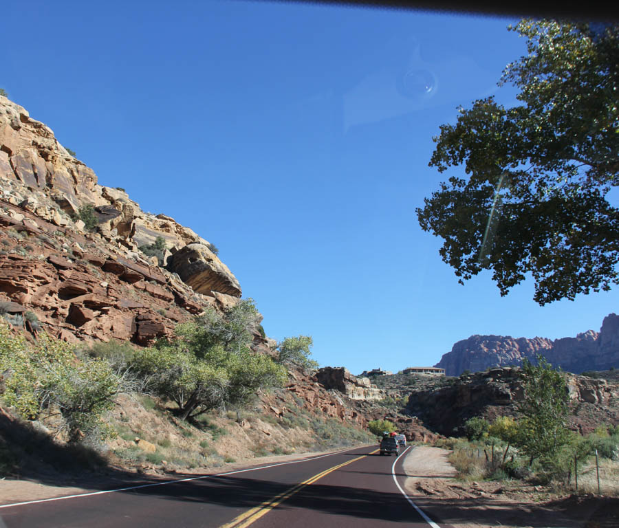
We are on our way to Zion
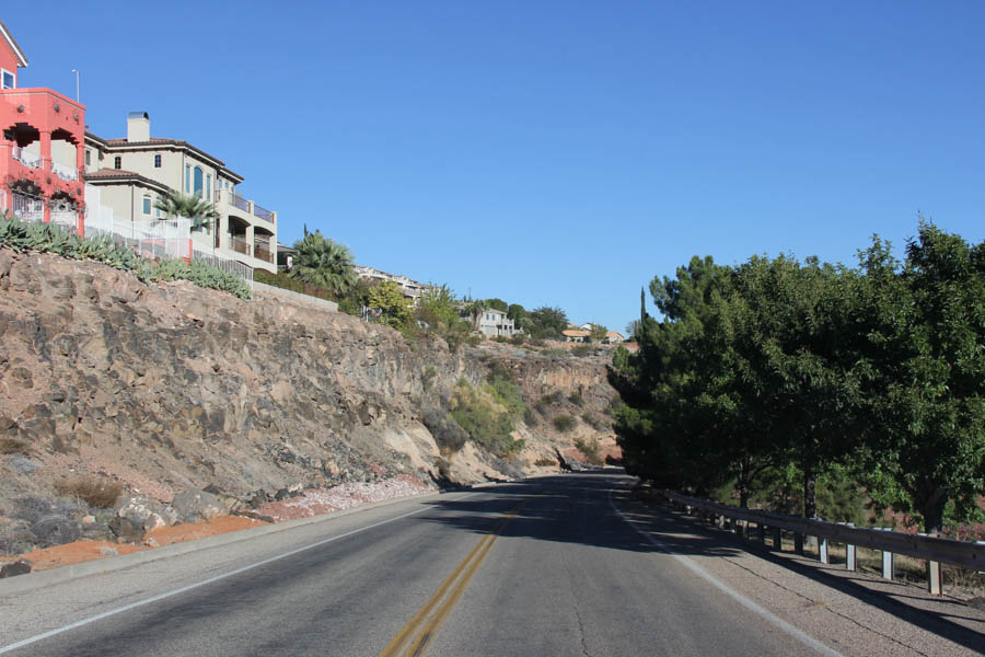
The houses on the bluff have a fantastic view

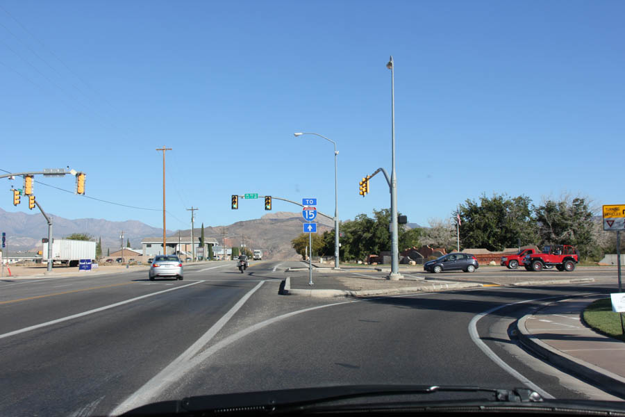
Across town to I-15 and then turn onto SR-9
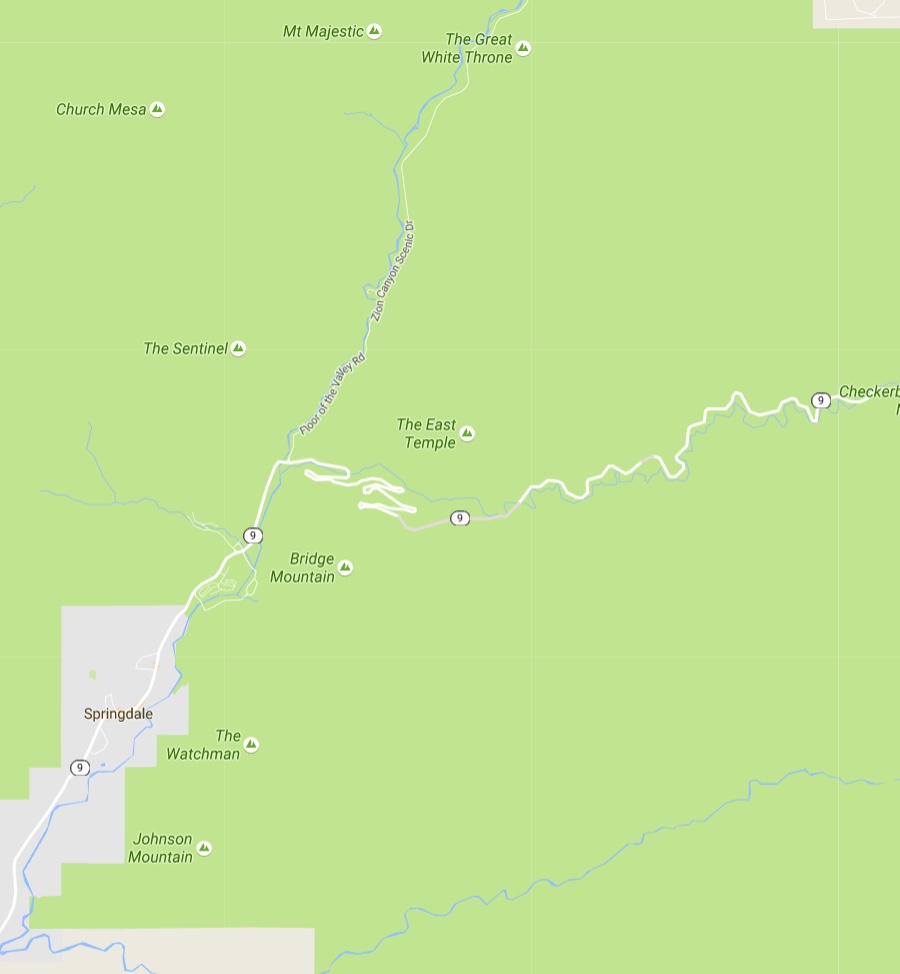
Our first destination was Zion National Park which is located in the Southwestern United States, near Springdale, Utah.
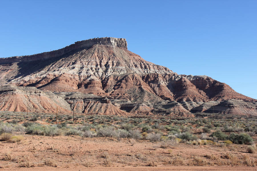
A prominent feature of the 229-square-mile (590 km2) park is Zion Canyon, which is 15 miles (24 km) long and up to half a mile (800 m) deep, cut through the reddish and tan-colored Navajo Sandstone by the North Fork of the Virgin River.
The lowest elevation is 3,666 ft (1,117 m) at Coalpits Wash and the highest elevation is 8,726 ft (2,660 m) at Horse Ranch Mountain.
Located at the junction of the Colorado Plateau, Great Basin, and Mojave Desert regions, the park's unique geography and variety of life zones allow for unusual plant and animal diversity.
Did You Know? - State Route 9 (SR-9) is a state highway in southern Utah, serving Zion National Park. It starts at the western terminus at exit 16 on I-15, passing through Zion National Park, and ending at the eastern junction with US-89. The entire length of the highway has been designated the Zion Park Scenic Byway. There is a fee to travel through Zion National Park, but the Zion-Mt. Carmel Highway is open to private vehicles year-round.
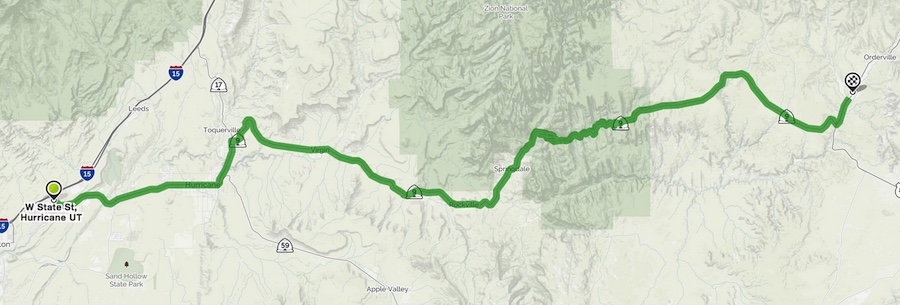
1hr 23min
- 58.2mi
Mount Carmel Highway.... A Closer look at the switchbacks
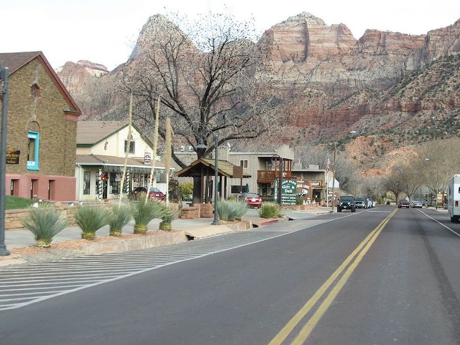
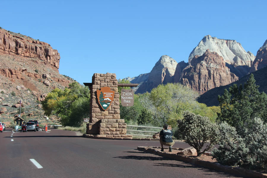
Springdale(Wikilink) (Entrance To Zion)
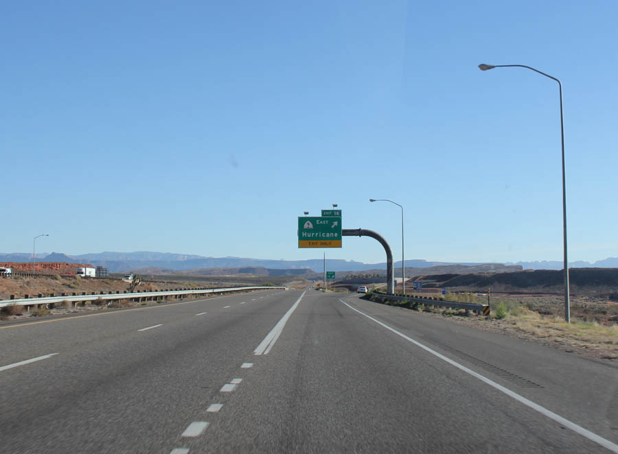
We pass through Hurricane Utah first
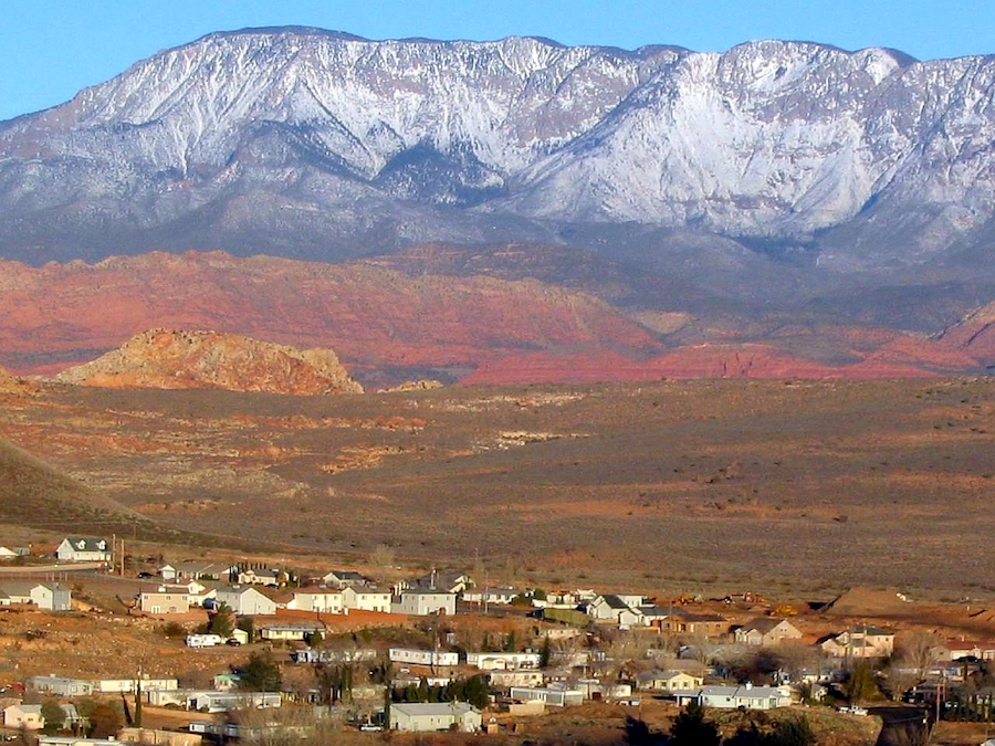
Did You Know? - Hurricane was first settled in 1896, and received its name after a whirlwind blew the top off of a buggy that Erastus Snow was riding in. Snow exclaimed, "Well, that was a Hurricane. We'll name this 'Hurricane Hill'."
Hurricane, which is pronounced "Hur-a-kin" by local residents (mimicking the accent of early Liverpool settlers), is in eastern Washington County. The community was settled as part of LDS Church President Brigham Young's 'Cotton Mission', intended to establish the southern end of Utah for agricultural purposes. The town once operated a large peach and apricot orchard for the LDS Church, and is historically known for growing peaches, pecans and pistachio nuts on small farms.
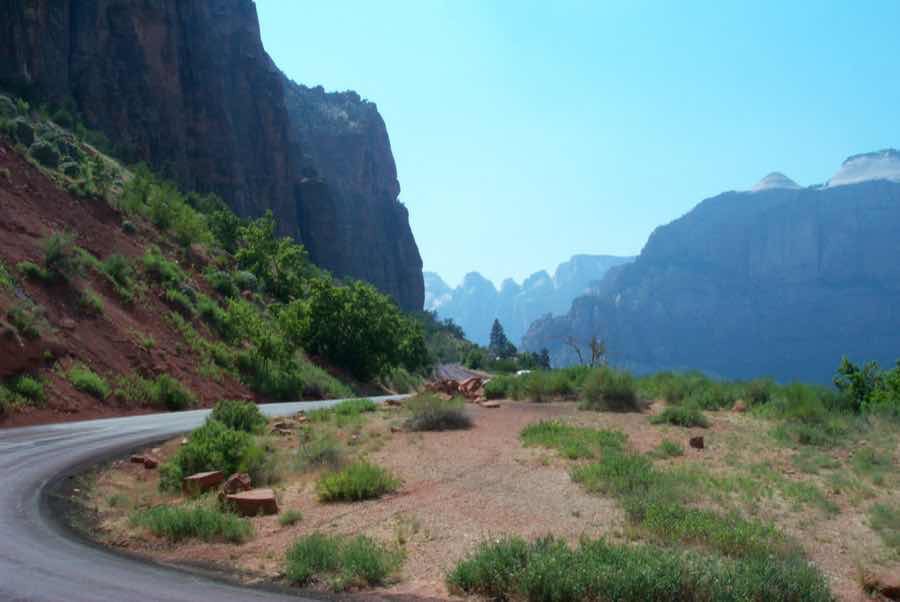
Looking back on Hurricane after you wind up SR-9 towards Springdale
We are now heading directly to Springdale

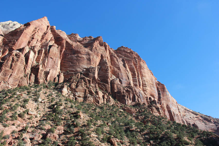
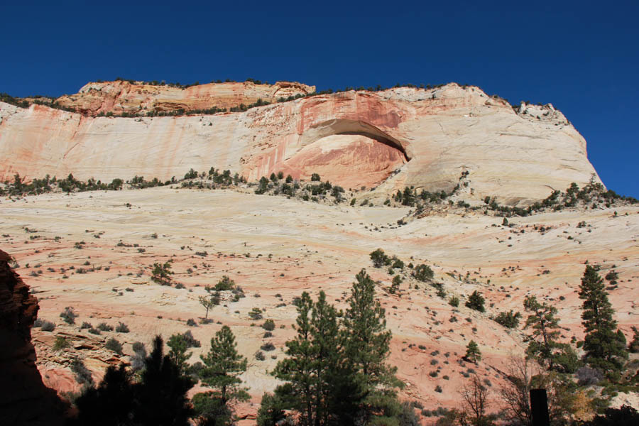
The top of the mountain was quite flat!
The geology was simply amazing
We wanted to stop but it was closed!

Looked like fun

On to Zion
On our way to Springdale.... We stopped here to clean our windshield
Looks like "Carsland's Radiator Springs" in Disney's California Adventure
Did You Know? -Springdale is a town in Washington County, Utah, United States. The population was 529 at the 2010 census. It is located immediately outside the boundaries of Zion National Park, and is oriented around the resulting tourist industry. It was originally settled as a Mormon farming community in 1862. Springdale was named one of the 20 'prettiest towns' in the United States by Forbes Traveler in 2008. Website

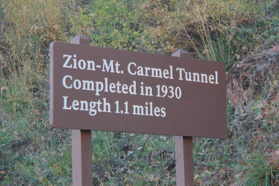
Did You Know? - In 1919, a Congressional bill designating Zion National Park was signed into law. In 1923 the task of finding a way to open Zion Canyon to the east side of the park began. Four different routes were considered including two options through Parunuweap and another through North Creek. The route chosen went up the side of Pine Creek canyon on switchbacks, through a tunnel and then along Clear Creek to the east boundary of the park, and hence to US-89 at Mount Carmel Junction.
Leaving town, Zion entrance is a few feet ahead!

We pulled over many times to take a picture

Zooooom!!

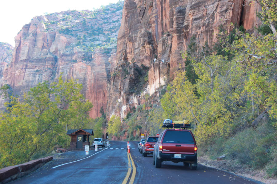
The traffic was pretty light

Because of our handicapped flag, the officer at the gate
signed us up for free entry to any national park!

It was free for us to enter... Otherwise it was about $30 to make the trip!

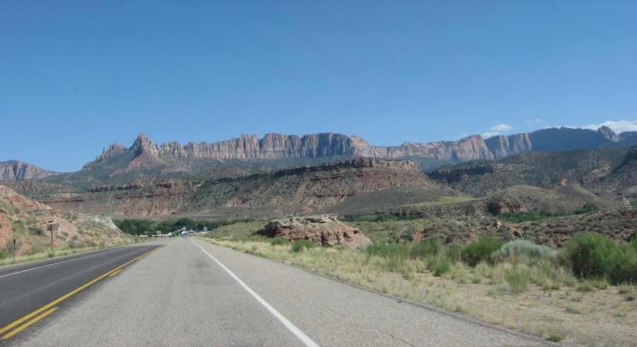
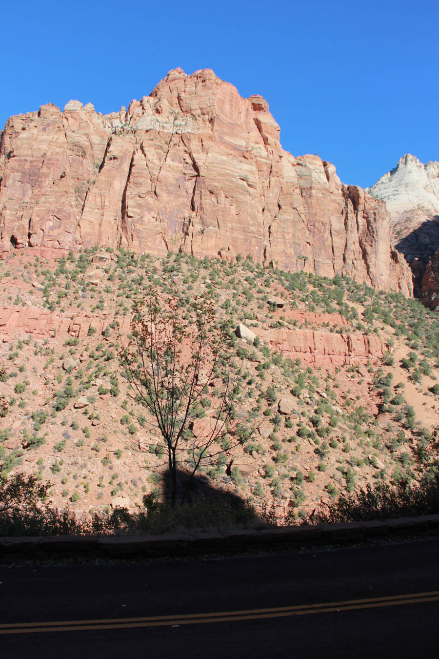
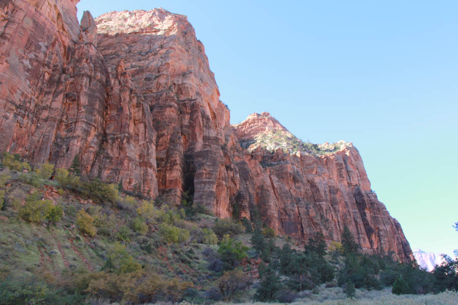
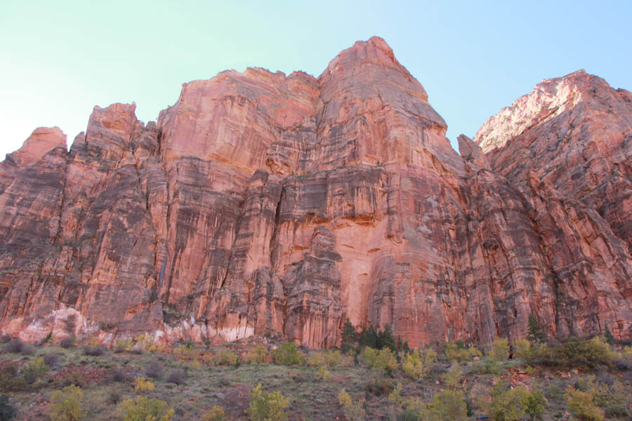
Mother Nature is simply fantastic
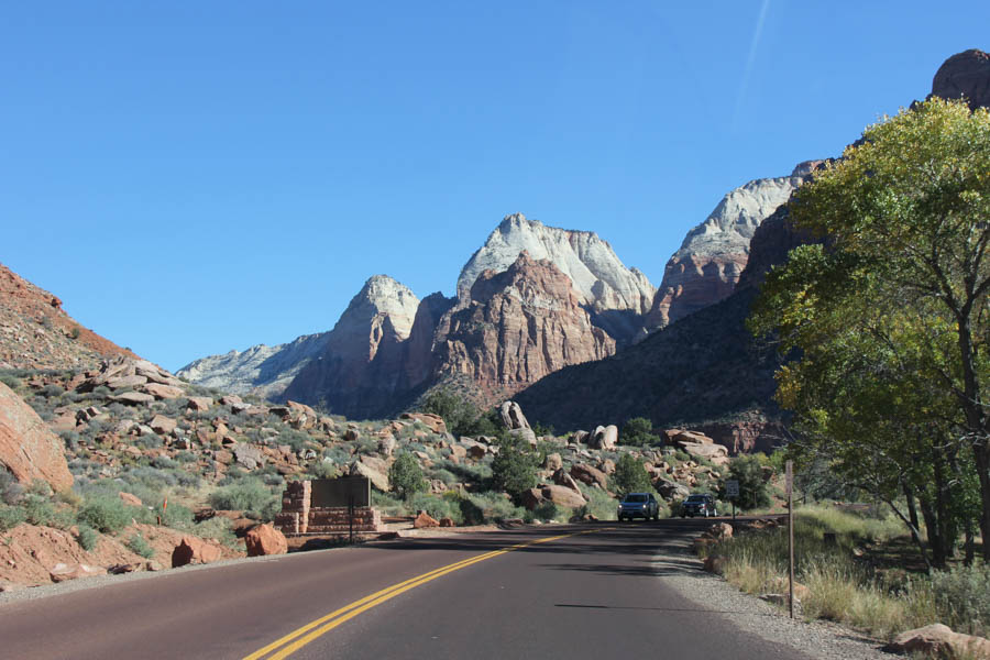
The mountains seemed to be carved by magic
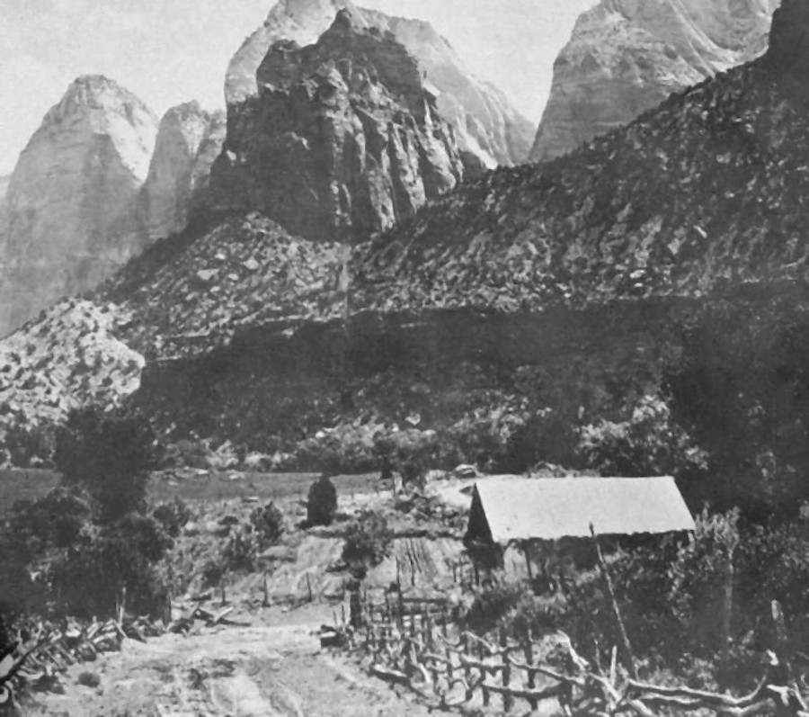
It wasn't always easy to traverse the area.... Crawford Ranch circa 1890
Did You Know? - The floor of Zion Canyon was settled in 1863 by Isaac Behunin, who farmed corn, tobacco, and fruit trees.
The Behunin family lived in Zion Canyon near the site of today's Zion Lodge during the summer, and wintered in Springdale. Behunin is credited with naming Zion, a reference to a place of peace mentioned in the Bible.
Two more families settled Zion Canyon in the next couple of years, bringing with them cattle and other domesticated animals. The canyon floor was farmed until Zion became a Monument in 1909.

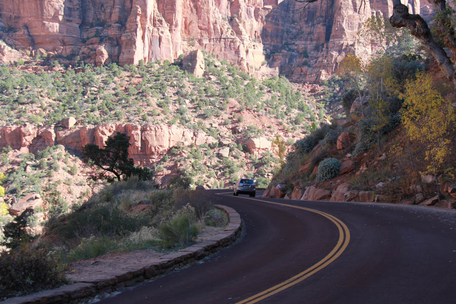
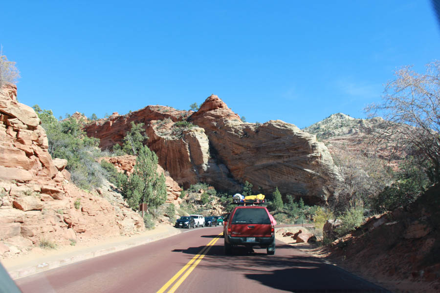
Switchbacks ahead!
Sheer mountains surround the road
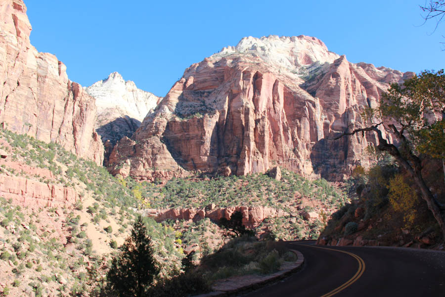
Spectacular!
Did You Know? - The 8,726-foot (2,660 m) summit of Horse Ranch Mountain (photo) is the highest point in the park; the lowest point is the 3,666-foot (1,117 m) elevation of Coal Pits Wash, creating a relief of about 5,100 feet (1,600 m).
Geologists must go nuts after seeing this!
There was little traffic....
We are glad we selected November!
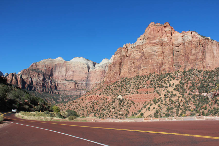
The red highway was formed by using the red rock in the making of the asphalt
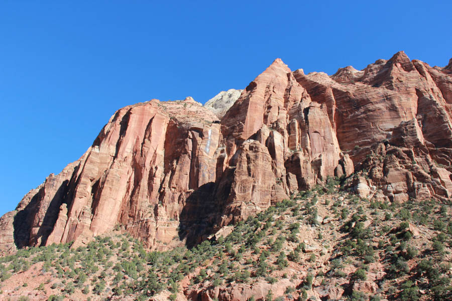
Just amazing!
 Waiting for the side of the hill to drop some more rocks might take a long time
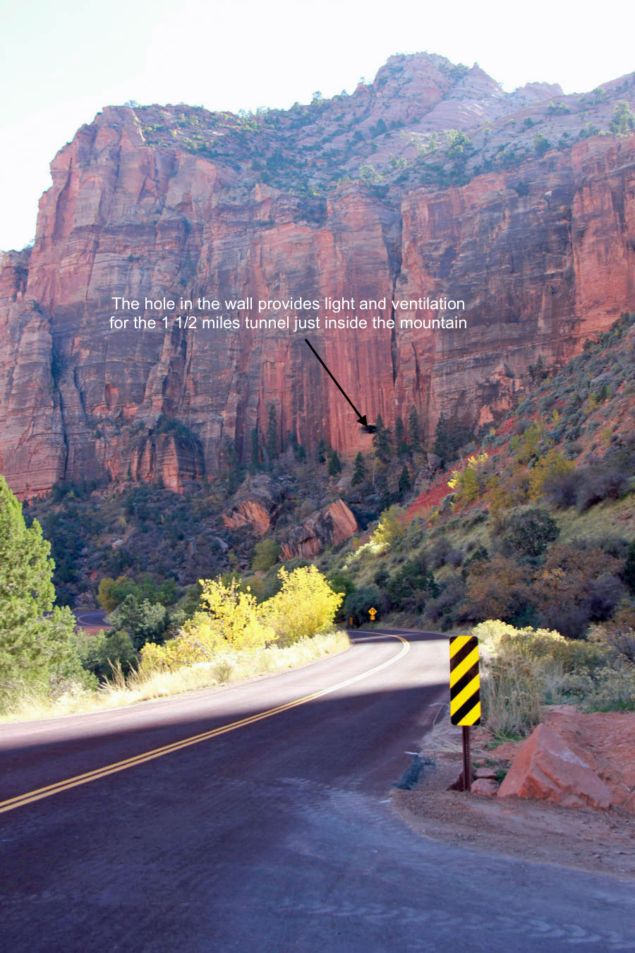
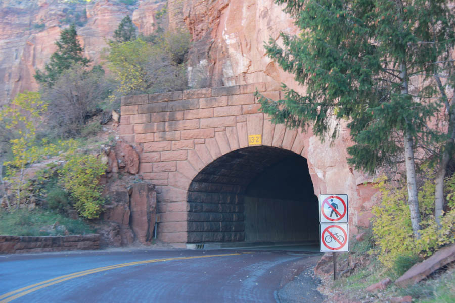
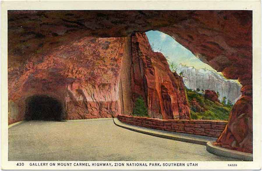
Look carefully at the "gallery" on the wall.... The tunnel is behind it!
Did You Know? - The tunnel uses galleries to provide light and ventilation through the canyon wall to the outside air. The galleries also provided a place to dispose of rock generated during construction, which was dumped through the galleries into the canyon. Parking spaces were originally provided at the galleries, but were discontinued due to safety concerns. Some galleries have been repaired and partially closed with concrete due to damage from rockslides.
Straight up into the sky!
Makes us feel a tad small!
Built 80 + years ago (2016)
 Inhaling was a good idea when going through the tunnels
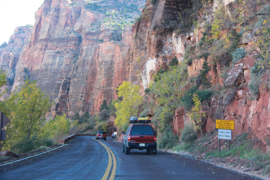
We had to wait a bit for a wide load to come through
Did You Know? - Work on the Zion – Mount Carmel Highway started in 1927 to enable reliable access between Springdale and the east side of the park.
The road opened in 1930 and park visit and travel in the area greatly increased.[29] The most famous feature of the Zion - Mount Carmel Highway is the 1.1-mile (1.8 km) Zion - Mt. Carmel Tunnel, which has six large windows cut through the massive sandstone cliff.
Here we go!
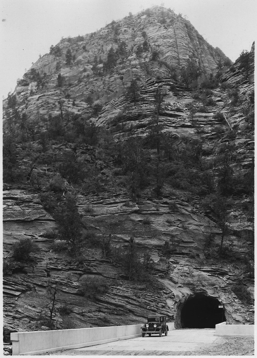
In 1930 the tunnel was "really wide"... Cars grew and the tunnel shrunk!

A horseback party at the western entrance to Zion Tunnel.
The tunnel shortened the distance from Zion to Bryce by 70 miles. 1929
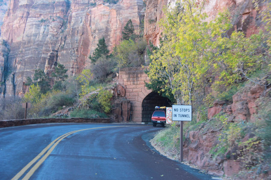
Here we go.... A mile of tunnel ahead!
We did not take pictures inside... Too scary
When the sun is just right and there is no traffic! The cutout lanes no longer exist
Did You Know? - Work on the tunnel was started in 1927 by the Nevada Construction Company and was completed in 1930 at a cost of $503,000.
At the time of its completion it was the longest non-urban road tunnel in the United States.
The tunnel's restricted dimensions require that vehicles over 11.33 feet (3.45 m) in height or 7.83 feet (2.39 m) in width give advance notice so that two-way traffic can be shut down in the tunnel, allowing oversize vehicles to proceed down the center of the tunnel. Vehicles over 13.08 feet (3.99 m) tall and semi-trailers as well as bicycles and pedestrians are prohibited in the tunnel.
Exiting the tunnel but we found we have one more to go!

This one is small... Maybe 200 yards in length?

Smooth due to the millions of years of weather

Looked quite different than the red surroundings
When a piece gives way, it's pretty exciting...
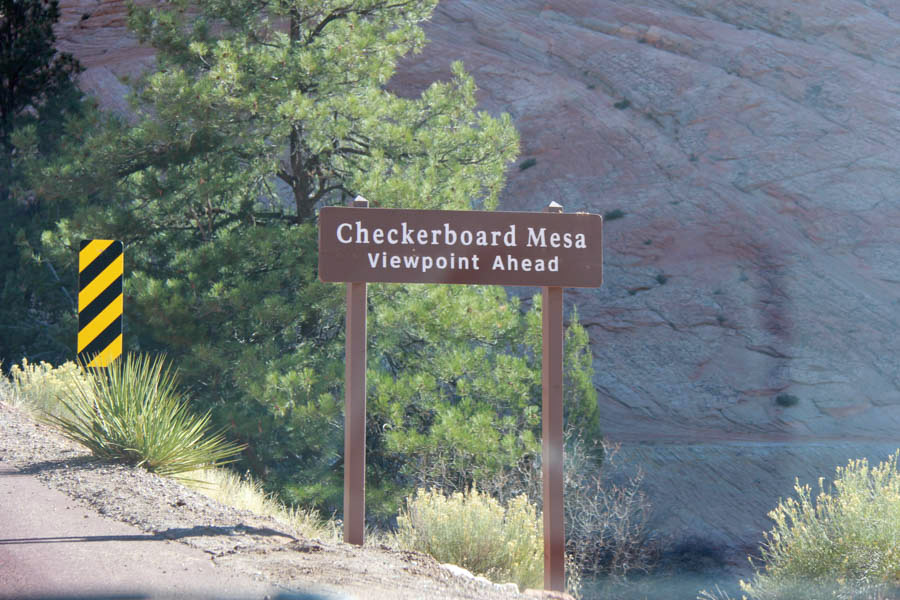
Checkerboard?

Well... If you squint it might be a checkerboard!
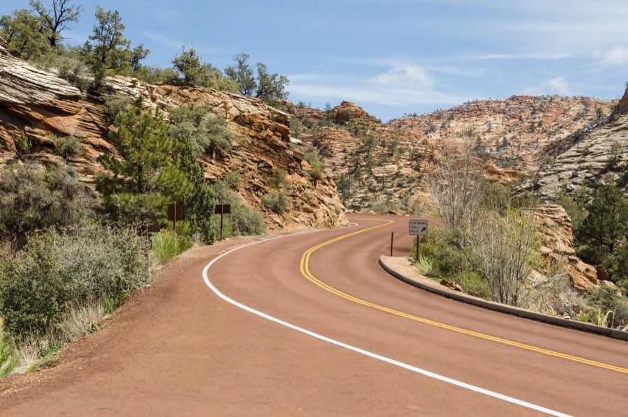
Narrow and winding road and then all of a sudden.... FLAT!